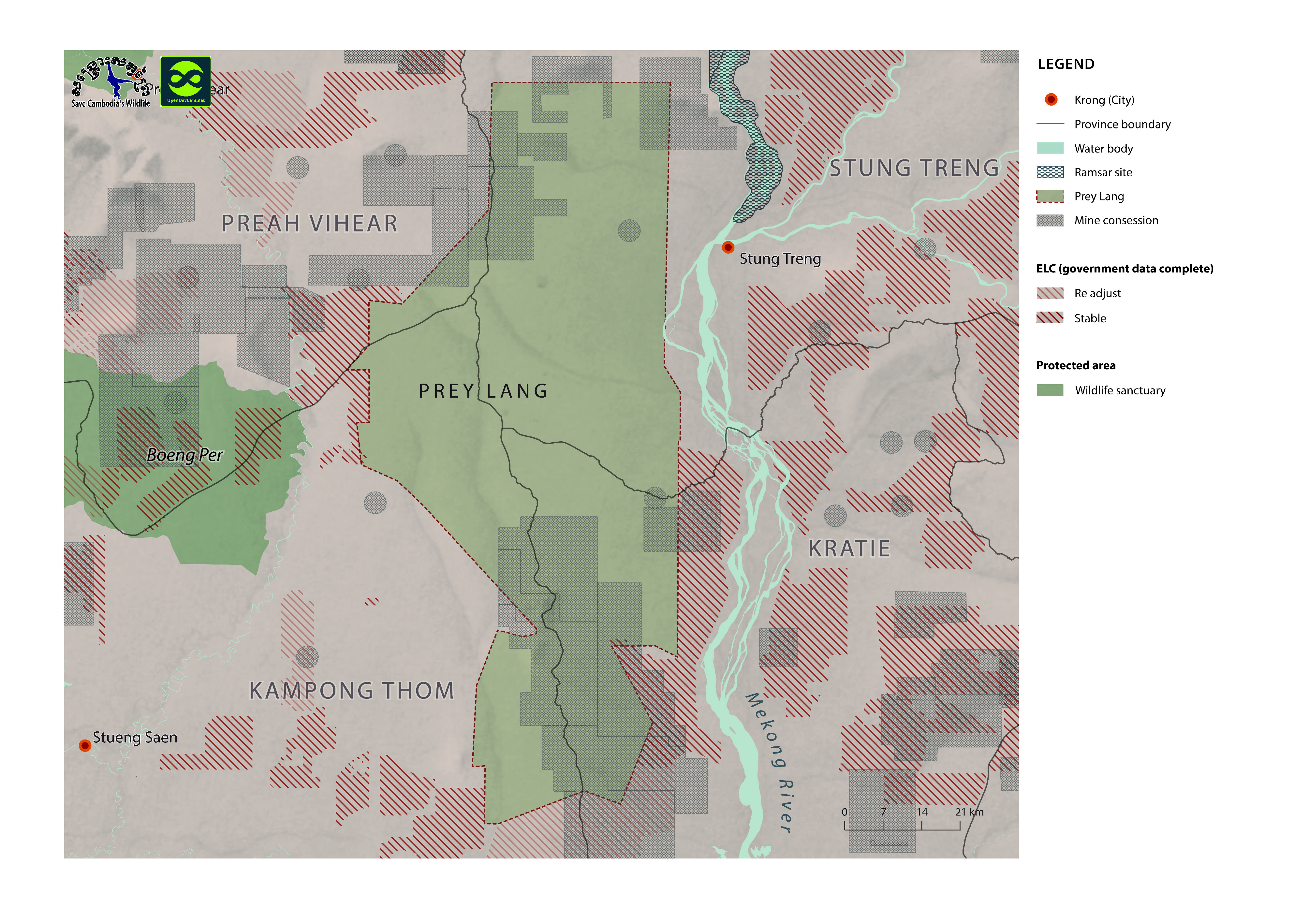
Prey Lang protected forest and biodiversity conservation area
ຈັດພິມໂດຍ: Open Development Cambodia
ແຫຼ່ງຂໍ້ມູນ (1)
ເບິ່ງຕົວຢ່າງຂໍ້ມູນ - Prey Lang protected forest and biodiversity conservation area
Additional Info
| Field | Value |
|---|---|
| ປະເພດຫົວຂໍ້ຊຸດຂໍ້ມູນ |
|
| ພາສາ |
|
| ວັນທີອ້າງອີງຂອງຊຸດຂໍ້ມູນ | 19 ມິຖຸນາ 2014 |
| ຊື່ທາງພູມສາດ |
|
| ຄວາມຊັດເຈນດ້ານທີ່ຕັ້ງ | There are no known issues with accuracy. |
| ຄວາມສອດຄ່ອງຕາມເຫດຜົນ | There are no known issues with logical consistency. |
| ຄວາມສົມບູນຂອງຂໍ້ຊຸດມູນ | There are no known issues with completeness |
| ຂັ້ນຕອນການປະມວນຂໍ້ມູນ | Available data was collected from many sources by ODC’s mappers such as government, news, company profiles, reports and NGO agencies in both pdf and shapefile format. |
| ແຫຼ່ງທີ່ມາ | Open Development Cambodia, contact@opendevcam.net, +855 23 221 164, http://www.opendevelopmentcambodia.net, 43 St. 208, Sangkat Boeung Riang, Khan Daun Penh, Phnom Penh, Cambodia. |
| ໜ່ວຍງານຮັບຜິດຊອບ | Open Development Cambodia, contact@opendevcam.net, +855 23 221 164, http://www.opendevelopmentcambodia.net, 43 St. 208, Sangkat Boeung Riang, Khan Daun Penh, Phnom Penh, Cambodia. |
| ຂໍ້ມູນການສ້າງ metadata | Metadata last updated on 2015-12-06. For inquiries contact: Open Development Cambodia, contact@opendevcam.net http://www.opendevcam.net 43 St. 208, Phnom Penh, Cambodia. |
| ສັນຍາລິຂະສິດ | CC-BY-4.0 |
| ລິຂະສິດ | No |
| ເວີຊັ້ນ | 1.0 |
| ວັນທີອັບໂຫຼດ | ທັນວາ 6, 2015, 21:18 (UTC) |
| ວັນທີດັດແປງ | ມິຖຸນາ 13, 2018, 01:51 (UTC) |