Access to health facilities
Published by: Open Development Cambodia
Data Resources (5)
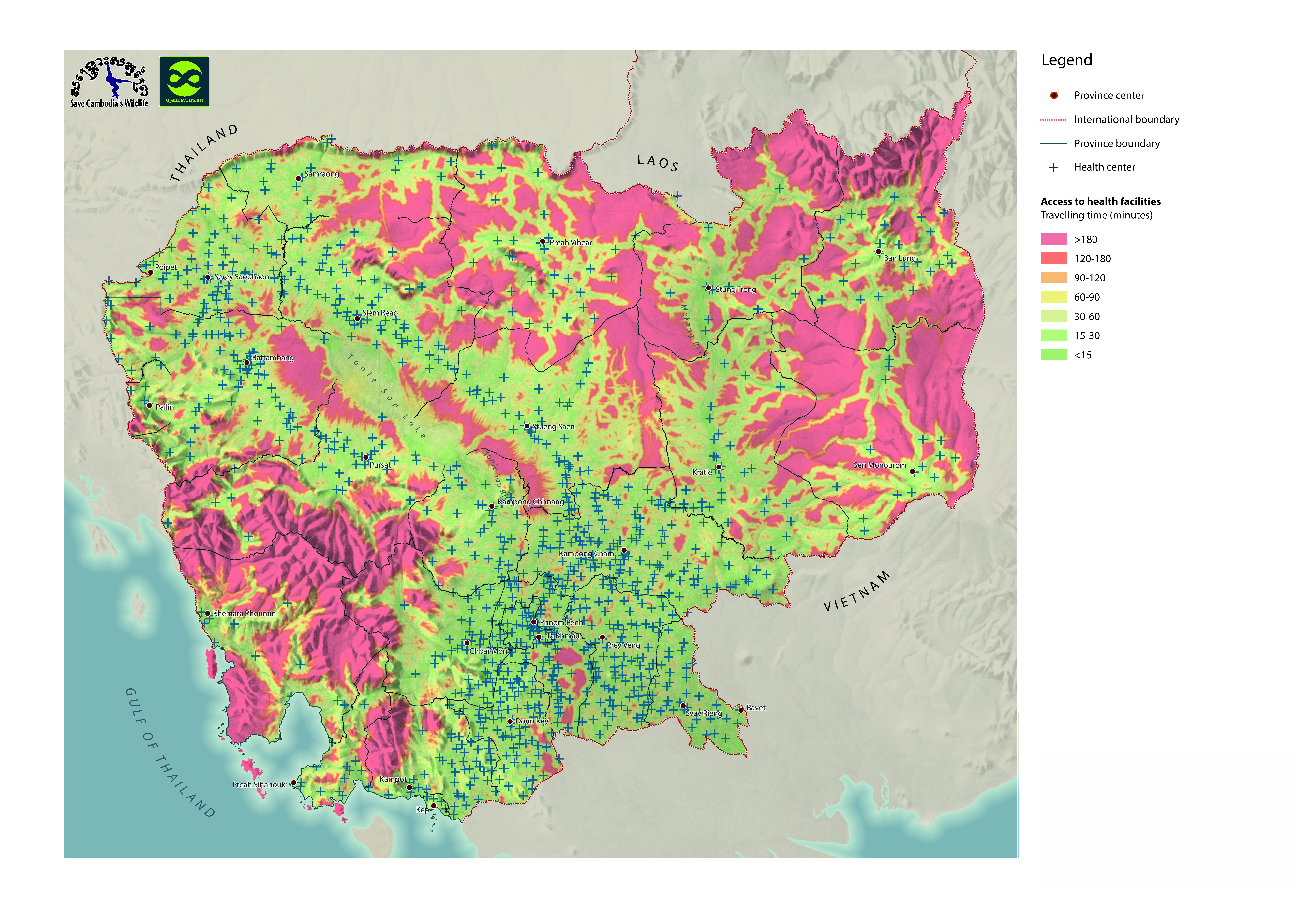
Data Resource Preview - Access to health facilities
Additional Info
| Field | Value |
|---|---|
| Dataset topic category |
|
| Language |
|
| GeoNames |
|
| West bounding coordinates | 102.32394290877996 |
| East bounding coordinates | 107.64725323456732 |
| South bounding coordinates | 10.341318835220985 |
| North bounding coordinates | 14.702476352330477 |
| Spatial Reference System | WGS 84 / UTM zone 48N (EPSG:32648) |
| Positional Accuracy | There are no known issues with accuracy. |
| Logical Consistency | There are no known issues with logical consistency. |
| Completeness | There are no known issues with completeness. |
| Process Step | A |
| Lineage | A |
| Responsible party | Save Cambodia's Wildlife (SCW), info@cambodiaswildlife.org, +855 23 88 20 35 http://cambodiaswildlife.org, 6Eo St. 570, Sangkat Boeung Kak 2, Khan Tuol Kork, Phnom Penh, Cambodia. |
| Metadata creator information | Metadata last updated on 2015-12-06. For inquiries contact: Open Development Cambodia contact@opendevcam.net +855 23 221 164 http://www.opendevelopmentcambodia.net 43 St. 208, Sangkat Boeung Riang, Khan Daun Penh, Phnom Penh, Cambodia. |
| Attributes | No attributes. |
| License | CC-BY-4.0 |
| Copyright | No |
| Version | 1.0 |
| Date uploaded | October 4, 2015, 21:01 (UTC) |
| Date modified | May 10, 2023, 17:44 (UTC) |