Economic corridors of Cambodia
Published by: Open Development Cambodia
Data Resources (6)
Data Resource Preview - Economic corridors of Cambodia
Additional Info
| Field | Value |
|---|---|
| Dataset topic category |
|
| Language |
|
| Use limitations | No access and use constraints. |
| Dataset reference date | January 2, 2012 |
| GeoNames |
|
| West bounding coordinates | 102.551300048828 |
| East bounding coordinates | 107.504234313965 |
| South bounding coordinates | 10.4262790679932 |
| North bounding coordinates | 13.9100093841553 |
| Spatial Reference System | WGS 84 (EPSG:4326) (CRS:84) |
| Positional Accuracy | |
| Logical Consistency | |
| Completeness | |
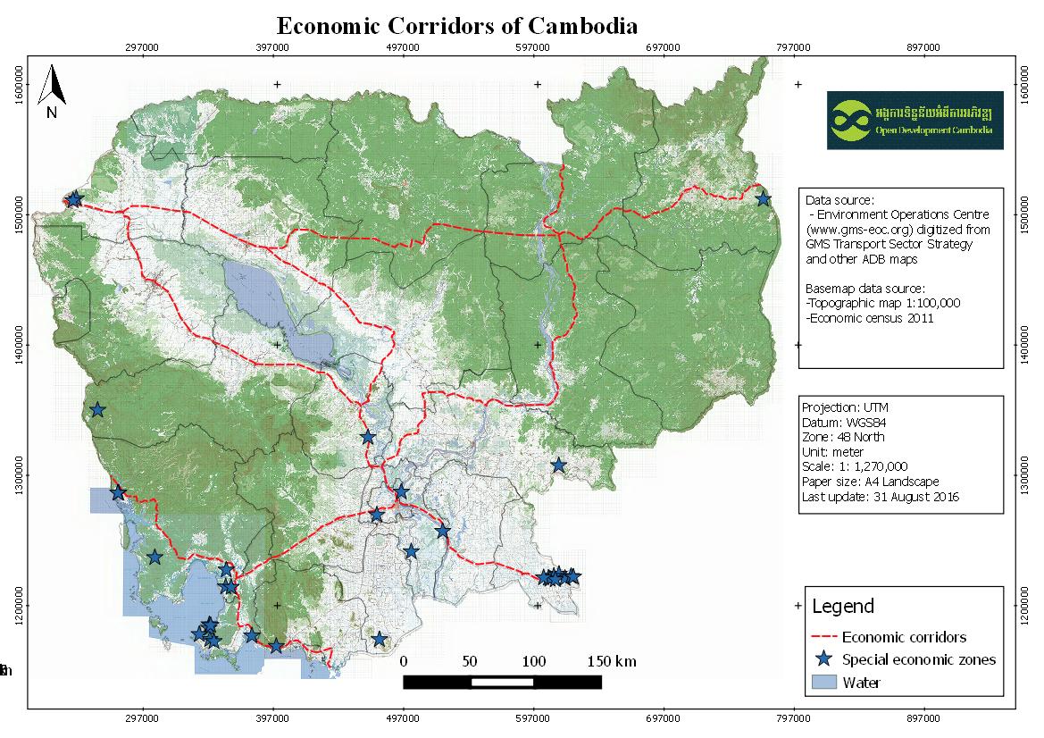
| Process Step | The data was visualized in CartoDB and created a custom legend and information windows for data points. Subsets of this data were created for presentation at country level. |
| Lineage | Environment Operations Centre (www.gms-eoc.org) digitized from GMS Transport Sector Strategy and other ADB maps. |
| Responsible party | |
| Metadata creator information | Metadata last updated on 2016-05-31. For inquiries contact: Open Development Cambodia Address: #43 St. 208, Phnom Penh, Cambodia. Email: contact@opendevcam.net Website: http://www.opendevcam.net |
| Attributes | |
| License | unspecified |
| Copyright | Unclear copyright |
| Version | 1.0 |
| Date uploaded | July 14, 2015, 10:34 (UTC) |
| Date modified | October 8, 2019, 16:25 (UTC) |